Overview of the project

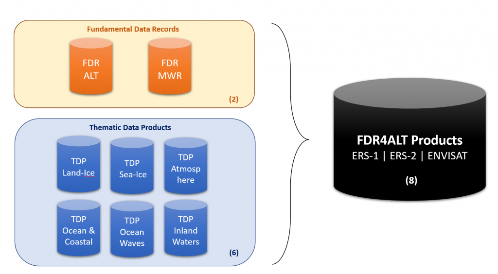
Fundamental Data Records for Altimetry (FDR4ALT) is an ESA project aiming at generating innovative Earth system data records named Fundamental Data Records (basically level 1 altimeter and radiometer data) and Thematic Data Records (basically level 2P geophysical products), in the frame of the European Long Term Data Preservation Program (LTDP+).
These products will be based on the exploitation of measurements acquired by the altimeter and radiometer instruments onboard three remote sensing satellites, ERS-1, ERS-2 and ENVISAT.
The goal is to serve the different communities involved in long term data exploitation over the different Earth surfaces: ocean, coastal, inland water, ice sheets, sea ice and atmosphere.
Dataset
ERS-1, ERS-2 and ENVISAT Altimeter and Radiometer dataset have been reprocessed in NetCDF format, based on the best state-of-the-art algorithms/corrections with definition and provision of innovative level-1 and level-2P products including uncertainty information at both levels.
Project Planning
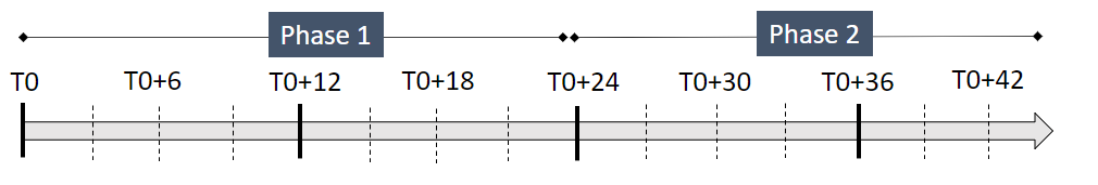
Phase 1 : Processing selection and products definition (completed)
- Completeness analysis
- Selection of the algorithms for the FDR & TDP products definition
- Definition of a validation plan
- Organisation
Phase 2 : Production and Validation (completed)
- Algorithm implementation in the CLS/CNES core system
- Massive p roduction of the FDR and TDP for the whole dataset (23 years of data)
- FDR and TDP validation
- Uncertainty characterization
The Project kicked off on September 2019 and the final meeting was held in Toulouse in May 2023.
Data Access
The FDR4ALT final products were released by ESA in March 2024 (see https://earth.esa.int/eogateway/news/fdr4alt-esa-unveils-new-cutting-edge-ers-envisat-altimeter-and-microwave-radiometer-datasets).
The data are openly available for download to anyone with an ESA EO Sign In account, via the dedicated ESA Online dissemination service .
For further details on the specific datasets, accessibility, and user registration, please visit the ESA FDR4ALT dataset description pages.
The Product User Guide can be found here : FDR4ALT_Products_User_Guide
FDR4ALT Follow-on
Note that ESA decided to continue with the FDR4ALT project for 3 additionnal years, to further improve the ERS-1, ERS-2 and ENVISAT products and propose a second version of the FDR4ALT products.