The Land-Ice Data Products (TDP) are taking into account the improvements made in the frame of the REAPER project and the ENVISAT reprocessing 3.0.
The Land-Ice TDP are also taking into account the improvements made at Level 0/Level 1 in the frame of FDR4ALT (ALT FDR).
The Land-Ice Thematic Data Products propose Level 2+ global product at 20Hz with a common product definition. An uncertainty value has been computed for each measurement.
Data Access
Data can be downloaded here
NetCDF groups
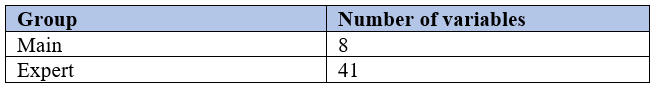
Products are split by passes. For each pass, two files are available depending of the user’s area of interest for land-ice : Greenland and Antarctica. Within each NetCDF file, there are two NetCDF groups (main and expert).
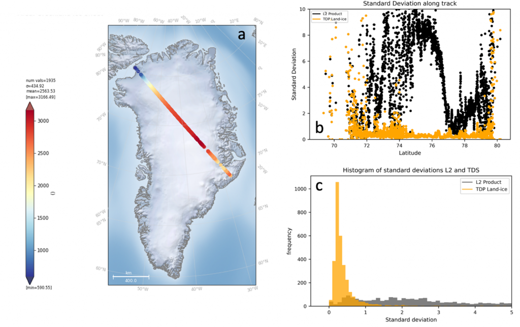
Improvements compared to existing products
Level-2
- Dedicated ice sheet retracking.
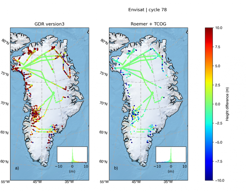
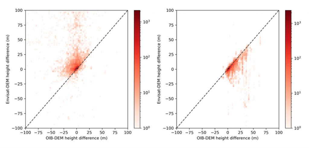
Enhanced slope correction The Non-linear method from Roemer finds the POCA (Point Of Closest Approach) based upon an external DEM. It has been used in many recent studies but is not implemented in ESA ground segments. It makes a better use of new high resolution elevation models (REMA & ArcticDEM). Compared to the linear slope correction approach used in current ENVISAT and ERS products, preliminary results show that :
-
- FDR4ALT products bias is reduced by an order of magnitude compared to ENVISAT V3 (from meters to 10 centimeters)
- FDR4ALT products dispersion of differences is reduced by more than two-thirds compared to ENVISAT V3 (from 3m to below 1m)
- Waveform classification
- Dedicated ice sheet quality flagging
Level-2P
- Topographic correction for across-track drift
- Homogeneous timeseries sampled at regular along-track reference nodes
Validation results
People in charge :
Lancaster University : m.mcmillan@lancaster.ac.uk